
🤝 Top Collaborators


.png&w=640&q=75)

🤓 Latest Submissions
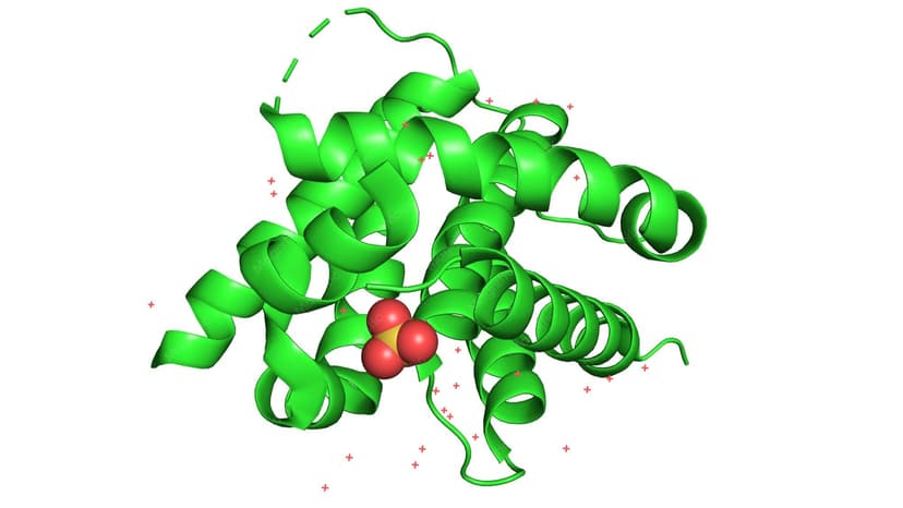
Autonomous AI Agents for CRISPR Diagnostics
Our project addresses the critical gap in healthcare accessibility across Africa by leveraging advanced autonomous AI agents to automate and streamline CRISPR diagnostics and complex clinical workflows. Powered by state-of-the-art large language models like Meta-Llama-3-8B-Instruct, the system acts as an intelligent layer capable of parsing complex genetic data, validating clinical outputs, and providing real-time decision support for healthcare providers. By optimizing laboratory diagnostics and handling administrative clinical structures autonomously, the platform dramatically reduces latency times, eliminates manual errors, and guarantees high-precision medical analysis. This ensures that cutting-edge precision healthcare becomes fast, affordable, and scalable for underserved populations.
19 May 2026

VISION-LINK AI INNOVATORS
VISION-LINK AI INNOVATORS presents a production-ready, automated multi-agent AI orchestration architecture built specifically to solve the high-cost hardware dependency barrier for enterprises and deep research domains like genomics. Core Architecture & Technical Approach Our system operates on a decentralized multi-agent ecosystem managed by a dynamic backend orchestration layer. Instead of relying on expensive, heavy, and power-consuming local GPU setups, our framework leverages distributed remote HuggingFace Inference APIs. The core orchestration intelligence dynamically loads, queries, and switches between specialized large language models and analytical models based on real-time task complexity. Dynamic Fitness & Schema Validation The backbone of our repository relies on custom runtime fitness metrics that continuously monitor API latency, response accuracy, and token efficiency. To ensure enterprise-grade data integrity, we implemented a strict live schema validation layer that screens all JSON data packets before they are parsed into production databases, ensuring zero structure mismatches during high-throughput operations. Strategic Impact By utilizing optimized remote compute endpoints rather than continuous idle local hardware, our architecture significantly lowers operational costs (OpEx) for scaling enterprise AI workflows. This makes advanced intelligent systems accessible, highly adaptable, and environmentally cost-effective for modern industries.
19 May 2026
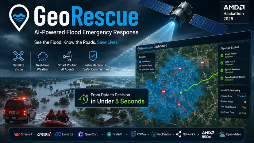
GeoRescue: Omni GIS Agent
GeoRescue is a multi-agent disaster response platform built for flood emergencies and hackathon-grade real-world impact. It gives first responders and command centers an instant operational view of flood conditions by combining satellite image analysis, live weather-driven flood modeling, road-impact detection, and safe route planning in one workflow. The system uses a CrewAI agent pipeline to coordinate four specialized roles: one analyzes satellite imagery, another triggers live flood intelligence, a third performs geospatial overlay analysis to identify blocked roads, and the last generates a structured incident report. The backend uses FastAPI, GeoPandas, OSMnx, NetworkX, and live weather inputs, while the UI presents interactive maps and clear response outputs. GeoRescue is designed to stay useful even when parts of the stack are unavailable, falling back gracefully to local routing and template reporting. The result is a practical, resilient disaster-response assistant that turns fragmented GIS and AI signals into actionable emergency guidance within seconds.
10 May 2026


